
STORM UPDATE: WETTEST PERIOD FRIDAY AFTERNOON
After showers on Wednesday underperformed expectations, there is hope that Friday will bring more widespread rainfall to the North Bay.
The low pressure center that’s been off the coast most of the week will be spinning a disturbance into the region with a better moisture source on Friday. This is also when the low will finally move inland across California.

By Friday afternoon the low pressure center will be poised just off the coast and tapping a decent moisture stream. (green)
The big change in the last 24 hours has been a more northerly forecast track for the low, sending more of the storm energy, and rain, into Northern California.

We can expect rain to begin around mid-afternoon and showers to continue into Saturday morning. There will be a small chance of thundershowers as the low pressure center moves inland near the Bay Area.

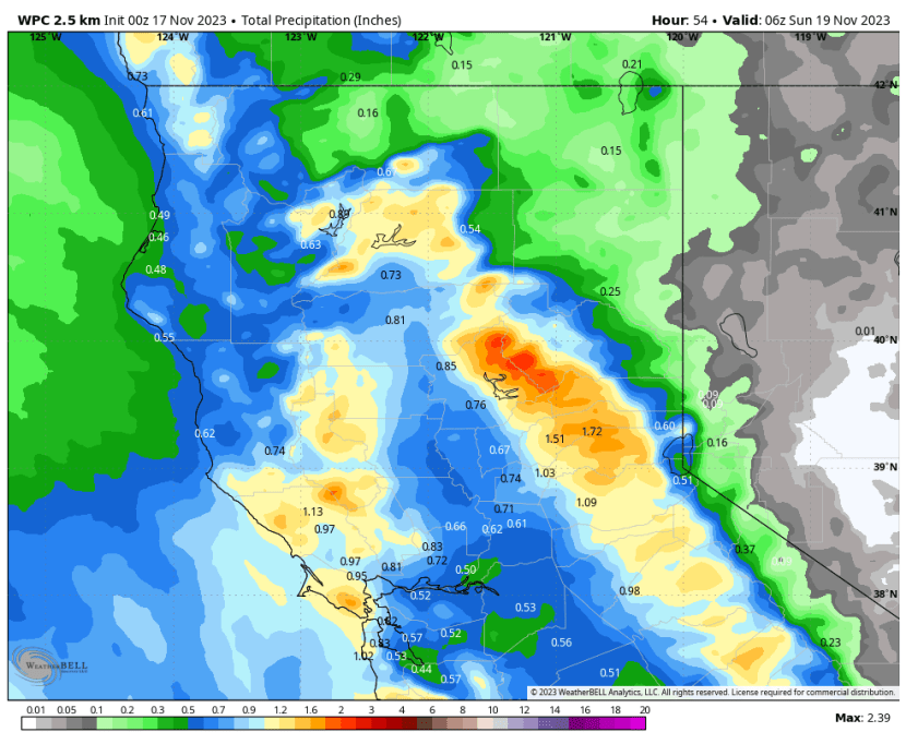
Rainfall should range from around a half inch to an inch (and perhaps more in the wetter spots).
Here’s how the WPC and European models see it panning out. The European is among the wettest outlooks currently, showing most of the North Bay receiving over an inch of additional rain by Sunday.

We’ll dry out by Saturday afternoon, with a warming trend through the first half of Thanksgiving Week.


Recent Comments