
SHOWERS NOW. MORE RAIN LIKELY WEEK OF 13TH
BIG PICTURE
After being brushed by a train of storms aimed at the Pacific Northwest, the coming week will be mostly quiet and mild across the North Bay. However, long range model outlooks point to a potentially stormy period during the week of November 13th.
DETAILS
The storms that brushed us Saturday-Monday brought beneficial light rain to the North Bay, with up to 3/4 of an inch in some places.

Far Northwestern California saw lots more rain over the past 48 hours, a good drenching in many areas.

The jet stream will be over California with showers possible through Tuesday. After that we’ll be mostly dry as a ridge of high pressure moves in.

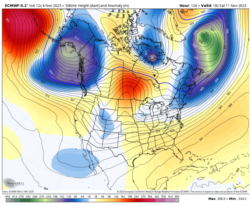
After this coming weekend the long range outlooks are in pretty good agreement on the return of a stormy period, with a deep trough of low pressure pushing in around the 14th or 15th. Both the European and GFS models see this.

Here is the European showing rain for the 15th and 16th.

The forecast southward dip in the jet stream is impressive.

Of course, more than a week out the models are unreliable. But at the same time model agreement is pretty good. And the major models that track trends, like the NOAA’s Climate Predication Center, agree on a wet period around mid-month.

Another good sign is that the CFS v2 model shows a wet period mid-month, after a dry week of November 6th.

So the trends are positive for more rain around mid-month. We’ll keep watching the outlook for the North Bay and update the forecast as things come into better focus.


Recent Comments