
Midsummer Heat Arriving this Weekend
After a couple of weeks of cooler than average weather, the North Bay’s typical midsummer heat is due return this upcoming weekend. And, the heat-up has already begun.
The satellite picture shows clear skies today except for coastal clouds, with high pressure starting to build in from the desert southwest.

Just how hot will we get? Forecast models show inland parts of the North Bay jumping into the mid to upper 90s both Saturday and Sunday, with 70s possible along the coast. A few spots could even reach 100 degrees.
Here is the GFS model forecast for Saturday….24 degrees above normal in central Sonoma County! If that can be believed, this translates to temperatures near or above 100 degrees!
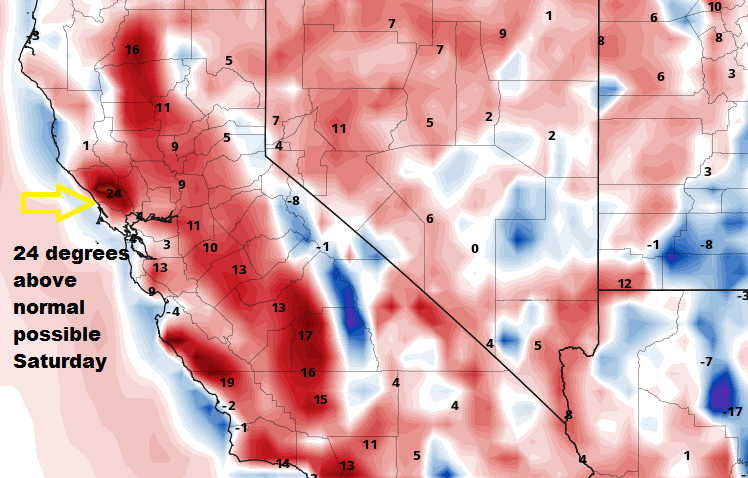
Still, the forecast calls for coastal stratus to hug the coast throughout the period, so that may moderate things a bit and keep us cooler than this forecast suggests.
Also, at this point there are not expected to be any stiff offshore winds or fire weather concerns, but of course that could change. By the early part of the coming week the heat should end as another cool trough enters the Pacific Northwest and that air reaches central California.


Recent Comments