All Eyes Now on Wind Event Late Sunday
As the hills of Sonoma County and the North Bay continue to experience moderate winds from the current wind event, forecasters are looking at the growing probability of another, even stronger period of high winds arriving late this weekend. Although details are still coming together, indications are that the upcoming event may impact a wider area and bring stronger winds than we’ve recently experienced.
With wildland fuels across Northern California at record dry levels, Cal Fire and regional fire agencies are at high alert.
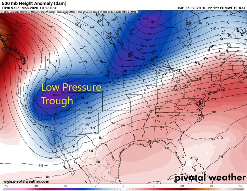
This is the forecast setup for late Sunday, when a cold trough passes to our east. This passage will tighten pressure gradients, and bring strong winds beginning late on Sunday.

Here is the current forecast for winds late Sunday through Monday. These are winds at approximately 2500 feet in the 40-50mph range corresponding with the highest peaks like Mt. St. Helena and Mt. Diablo. This event is still more than three days away, so this may change.

And the forecast for winds in greater detail for early Monday. Note sustained winds forecast in the 40-50mph range over the highest elevations of Sonoma County early Monday.

If this forecast holds, we will likely see Red Flag Warnings and Wind Advisories over the North Bay. PG&E power shutoffs are also likely. We will continue to monitor this upcoming weather event and keep you up to date as conditions warrant.


Recent Comments