STORM UPDATE: WHERE WILL IT GO?
The much hyped storm headed toward California for next week is giving forecasters major headaches. In the last 24 hours, major models have shifted from bringing the storm directly into California, to having it spin just off the coast before (mostly) heading south.
Obviously this has major implications for our weather and rainfall totals here in the North Bay and Bay Area.
The problem: atmospheric dynamics in the Eastern Pacific will likely create a deep, closed low off the CA coast. We know that. But, mostly cut off from the main steering winds, almost anything could happen with this low. Will it wander for a while, or get entrained in the developing southern jet stream expected to form over Southern California?
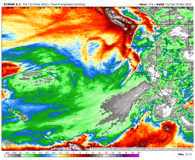
Take a look at the European Model, which is similar to all of the other major models today.
24 hours ago it had the low pressure center directly over the Bay Area and NorCal.

Now, one day later, it places this low hundreds of miles further west.

The impact on our rainfall is obvious. The wet forecast of 24 hours ago (first image), has been replaced by a much drier one (2nd image) showing the main rain action staying off the coast.


If this trend holds, credit the American GFS model with being the first to spot it. But don’t count on that. The models have been so variable with this storm that we could well shift back to a very wet forecast in the next 24 hours.
This is usually where forecasters look more closely at the ensemble forecasts, which look at dozens of possibilities, to see if there is any “clustering” around a specific outcome. As you can see in the image below, there are still plenty of individual members, about half or more, that see lots of rain for NorCal.
So, stay hopeful that we’ll get a nice storm for next week that will jump start our rainy season.
We’ll keep you updated.


Recent Comments